par Tiffou, Jacky (1943-....)
Armand Colin
2003 -
-
Disponible - 911.11 TIF
Niveau 2 - Géographie, urbanisme
Recherche simple :
par Tiffou, Jacky (1943-....)
Armand Colin
2003 -
Disponible - 911.11 TIF
Niveau 2 - Géographie, urbanisme
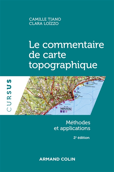
par Tiano, Camille ; Loïzzo, Clara
Armand Colin ; Dupliprint
2022 -
Disponible - 911.1(07) TIA
Niveau 2 - Géographie, urbanisme
par Steinberg, Jean (1942-....)
C.D.V.-Sedes
1982
Disponible - 911.1(07) STE
Niveau 2 - Géographie, urbanisme

par Institut national de l'information géographique et forestière (France).
IGN
2018
Disponible
Niveau 2 - Géographie, urbanisme

par Institut national de l'information géographique et forestière (France).
IGN
2012
Disponible - CARTES
Niveau 2 - Géographie, urbanisme

par Institut national de l'information géographique et forestière (France).
IGN
2012
Disponible
Niveau 2 - Géographie, urbanisme

par Institut national de l'information géographique et forestière (France).
IGN
2012
Disponible - CARTES
Niveau 2 - Géographie, urbanisme

par Institut national de l'information géographique et forestière (France).
IGN
2012
Disponible
Niveau 2 - Géographie, urbanisme
![Glandasse - col de la Croix-Haute : P[arc] N[aturel] R[égional] du Vercors](/imported_images/carte/couverture/978-2-7585-2599-8.jpg)
par Institut national de l'information géographique et forestière (France).
IGN
2012
Disponible
Niveau 2 - Géographie, urbanisme
![Le Tréport - S[ain]t-Valery-sur-Somme : Baie de Somme](/imported_images/carte/couverture/978-2-7585-2805-0.jpg)
par Institut national de l'information géographique et forestière (France).
IGN
2012
Disponible
Niveau 2 - Géographie, urbanisme

par Woerl, Joseph Edmund (1803-1865). Cartographe ; Herder, Bartholomä (1774-1839). Fonction indéterminée ; Weiss, Johann Heinrich (1759-1826). Cartographe
Herder'sches Kunst-Institut (Freiburg i. Br)
Résultat de Gallica : Cartes
par Woerl, Joseph Edmund (1803-1865). Cartographe
B. Herder (Freiburg [im Breisgau] Strassburg)
Résultat de Gallica : Cartes
par Woerl, Joseph Edmund (1803-1865). Cartographe ; Herder, Bartholomä (1774-1839). Fonction indéterminée ; Weiss, Johann Heinrich (1759-1826). Cartographe
B. Herder (Freiburg i.Br)
1870
Résultat de Gallica : Cartes
par Weiland, Karl Ferdinand (1782-1847). Auteur du texte ; Geographisches Institut (Weimar, Allemagne). Auteur du texte
im Verlage des geographischen Instituts (Weimar)
1814
Résultat de Gallica : Cartes
par Reymann, Gottlob Daniel (1759-1837). Cartographe ; Handtke, Friedrich (1815-1879). Cartographe ; Oesfeld, Karl Wilhelm von (1781-1843). Cartographe
C. Flemming (Glogau)
1869
Résultat de Gallica : Cartes
par Preussen. Geographisch-Statistische Abteilung. Cartographe
Geographisch-Statistische Abtheilung des Generalstabes (Berlin)
1879
Résultat de Gallica : Cartes